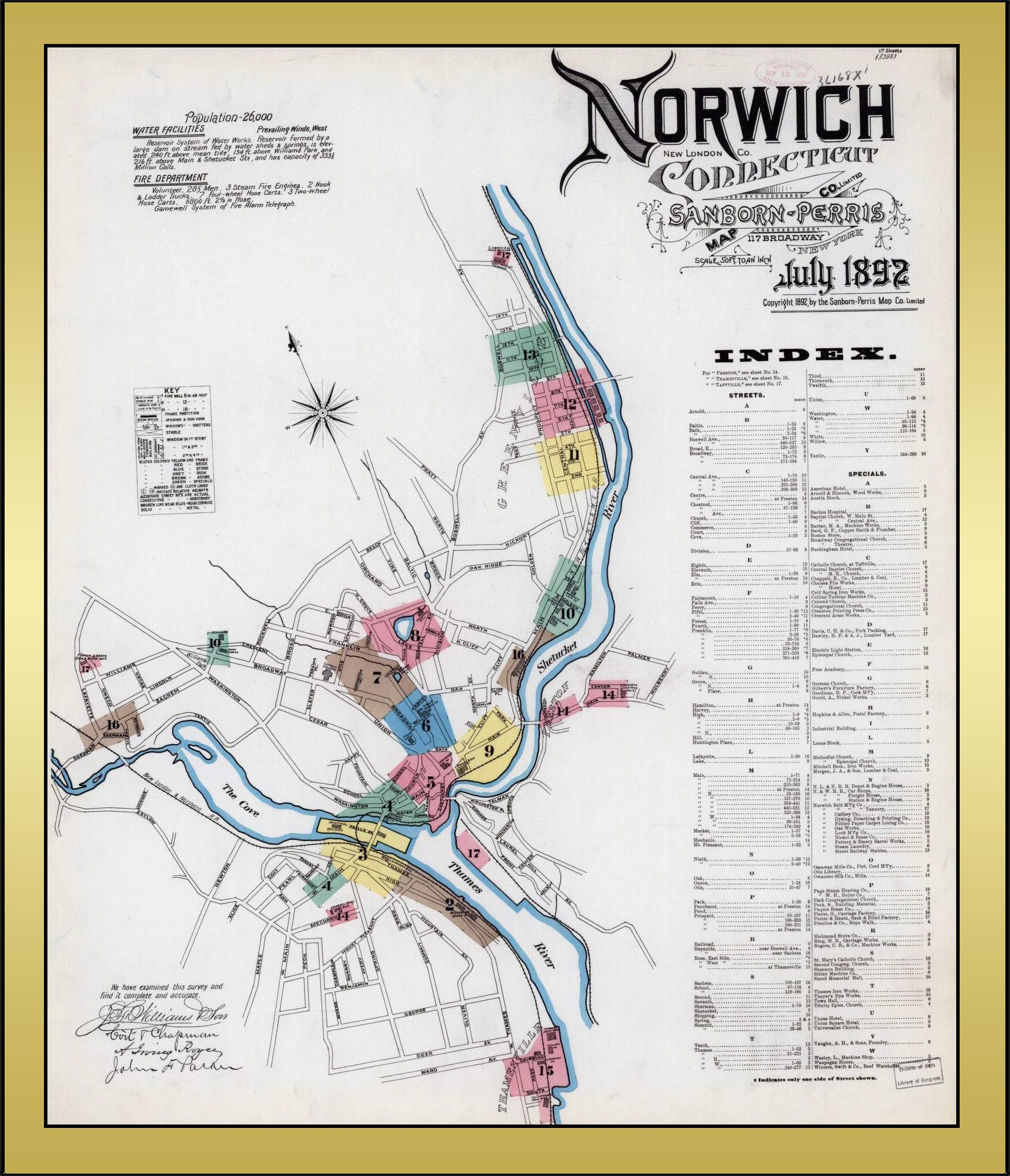
In July of 1892 the Sanborn-Perris Map Company issued a series of maps that provide a detailed view of many of the homes and businesses located in Norwich at that time. The map shown below is Map 1 of 17. This map provides an overview of the town and the boundaries of the 16 additional detailed maps. The 16 detailed maps are available for view at the Library of Congress website. If you click the button below, you will be redirected to the Library of Congress website, and you will be able to see much more detail.