In May 1659 residents of Saybrook petitioned the General Court of Connecticut for permission to create a settlement in the area that is now known as Norwich. On May 20, 1659 the Court approved and consented to:
“What is desired by ye petitioners, respecting the Mohegin, provided yt within ye space of three yeares they doe effect a plantation in ye place propounded”.
On June 6, 1659 the deed for the land was signed by Uncas and his sons for the price of 70 pounds sterling ($13,900 in today’s dollars). The plantation was first named Mohegan. After the initial survey of the land was completed in the fall of 1659 a few of the settlers removed from Saybrook to the new plantation and stayed there over the winter. However, the majority of the proprietors moved to Norwich in the spring of 1660. According to The Norwich Vital Records the town was renamed to Norwich in 1662.The jobs of interacting with the Mohegan, working with the General Court of Connecticut, surveying the land and communicating with the Saybrook residents were primarily done Reverend James Fitch and Major John Mason. Reverend Fitch was their spiritual leader and Major Mason was their statesman. At this point in his life, Major Mason was already one of the founders of three other colonial New England towns (Dorchester Massachusetts, Hartford Connecticut and Saybrook Connecticut) . He was in the latter part of his lifetime and ready to settle down.
The Town Plot was laid out along the Yantic River in a rustic frontier overlooking ridges of several hills. At that point-in-time the land was a wilderness and most likely only inhabited by the Mohegan. It is estimated there were 2000 Mohegan living there at the time.
The first proprietors, who became the founders of Norwich, were each granted a plot of land that needed to be cleared before they could build their homes. The Mohegan assisted in the preparation for their new habitations and many other ways.
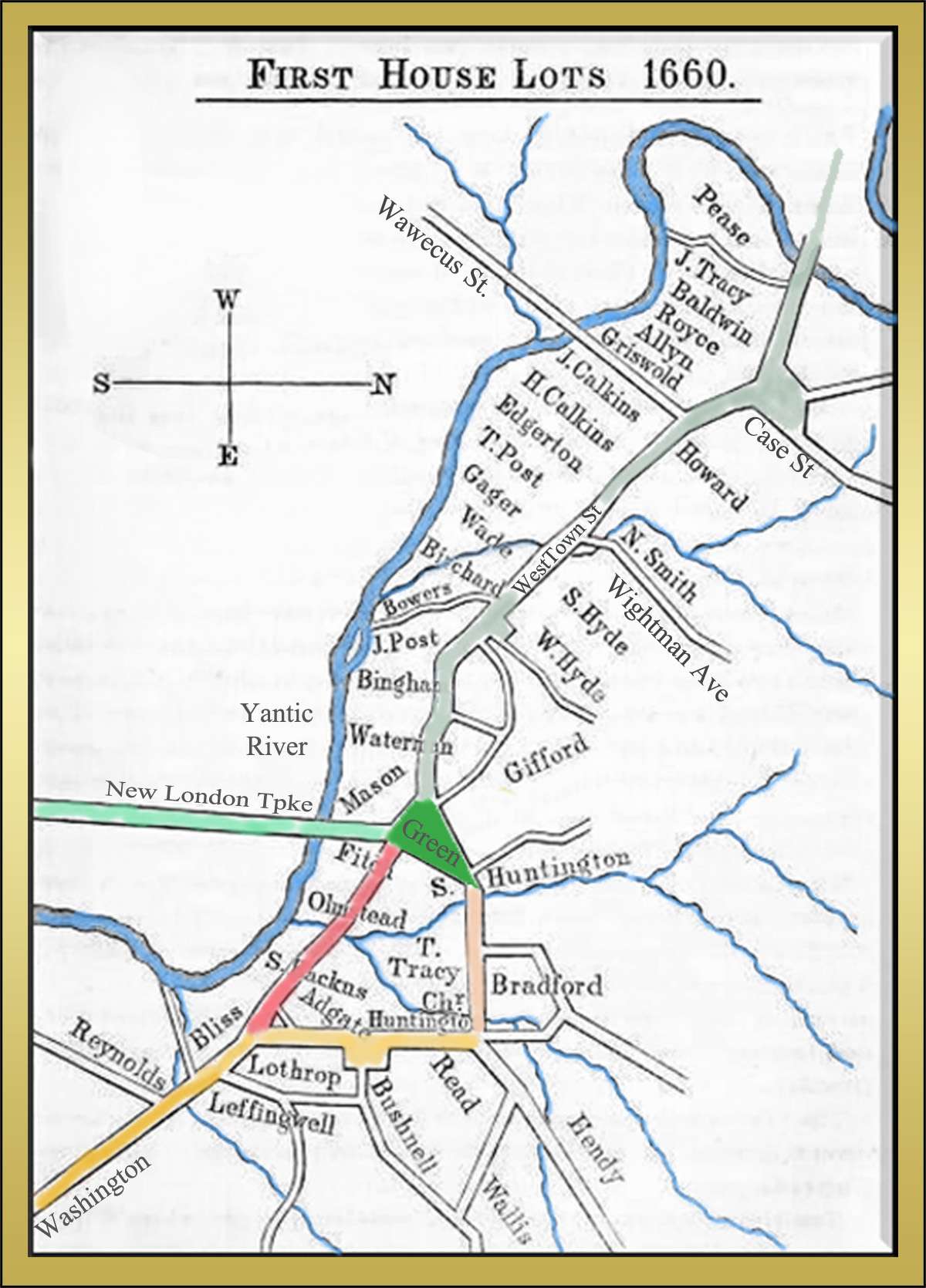
The map shown on the left shows specific locations of the original house lots. The map was adapted from Info Source 1.
The map below shows the boundaries and owners of lots in the southeastern part of the town in 1705, 45 years after the proprietors first arrived in Norwich. The map was adapted from Info Source 2.
The present-day names of streets and roads were added for clarity on both maps.
VITAL RECORDS
“The Norwich Vital Records, from 1659-1848” was compiled by the Society of Colonial Wars in the State of Connecticut was published in 1913. It includes the dates of thousands of births, deaths, and marriages in Norwich. You can view a copy of the book by clicking the button below.
“Genealogical Notes, Or Contributions to the Family History of Some of the First Settlers of Connecticut and Massachusetts, (1856)”, by Nathaniel Goodwin